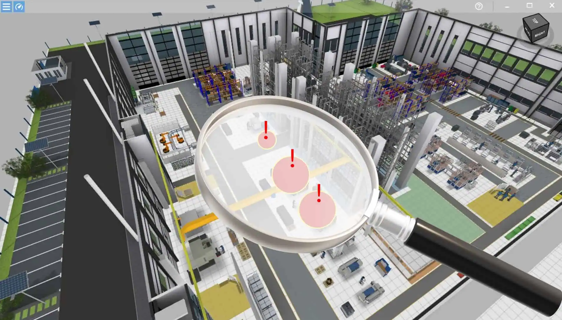
How good are Meshy models in planning?
When AI turns images into 3D models – opportunity or risk for factory planners? KI tools, like Meshy, generate impressive 3D models from simple images in just a few minutes. Sounds like a revolution in factory planning – and it is, at least to some extent. The article explains how Meshy works, where its strengths … Read more